Platform Interface
Real Agro Unit screens: dashboard, fields, tools, GPS telemetry, and solar energy monitoring.
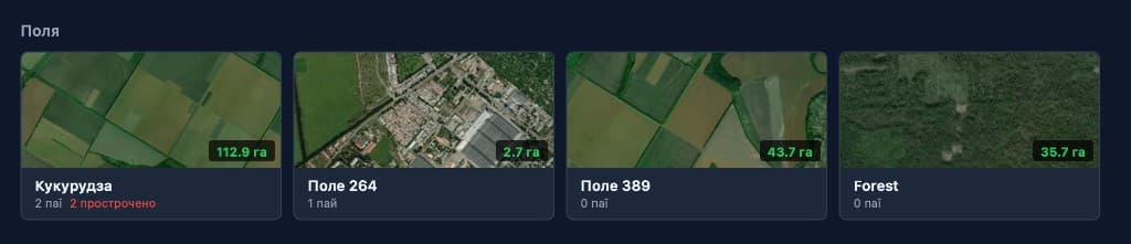
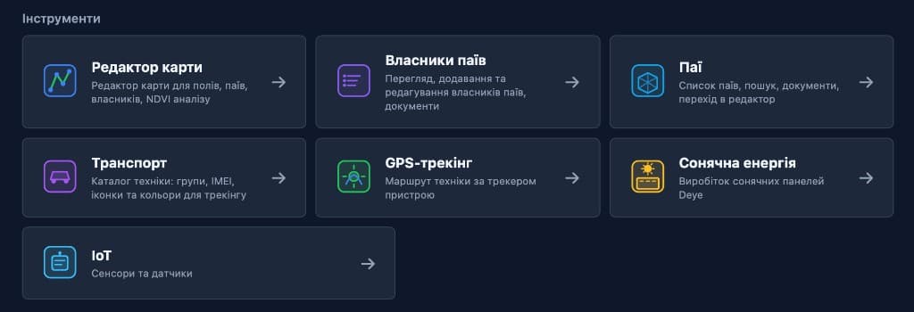
Dashboard & Fields
Summary stats, field cards with satellite previews, and quick access to all tools.

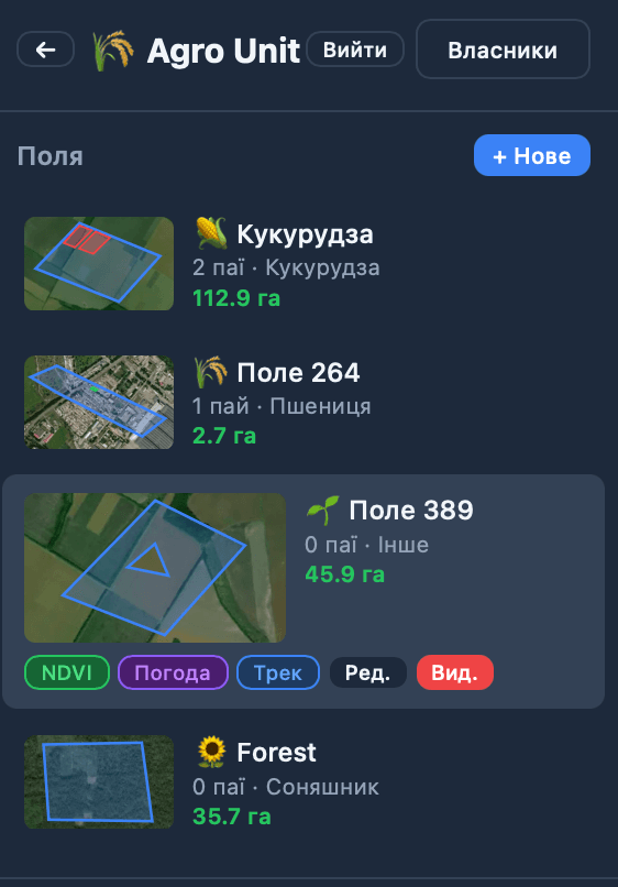
Mobile Interface
Full field access on the go — NDVI, weather, track, and editing.
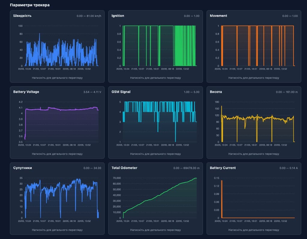
GPS Tracking & Telemetry
Real-time Teltonika tracker parameters: speed, ignition, movement, battery, GSM, odometer.
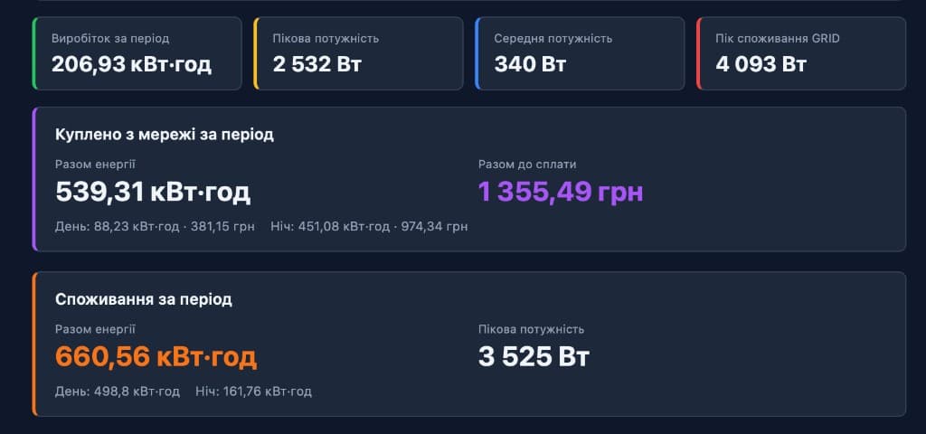
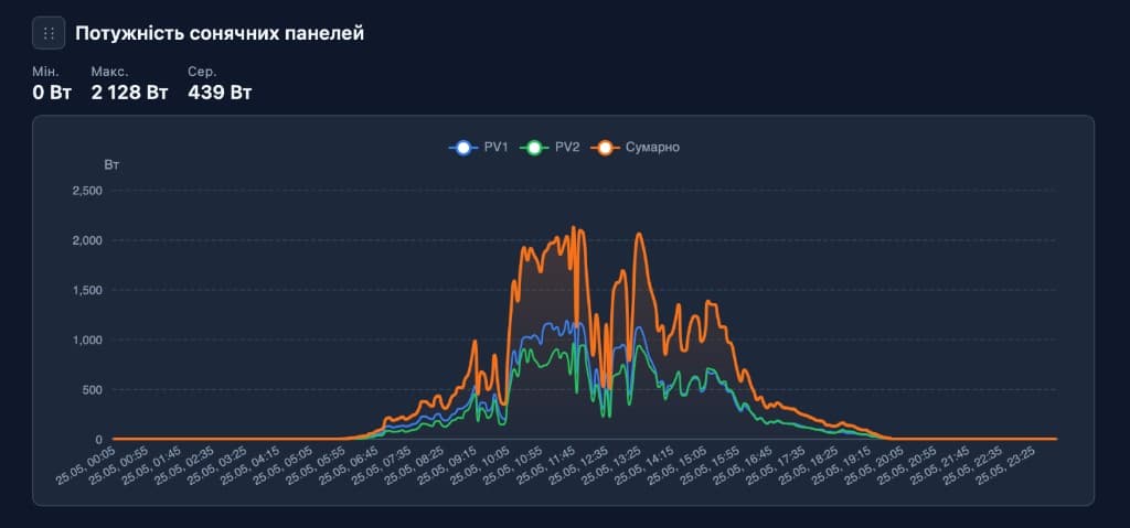
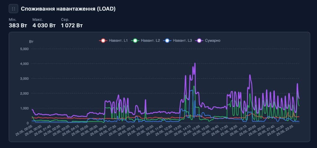
Solar Energy
Deye monitoring: production, consumption, grid import, and per-phase power.
Everything You Need
From satellite imagery and fleet tracking to fuel analytics, crop rotation planning, AI-powered insights, accounting, and multi-team management.
Interactive Map Editor
Draw, edit and manage field polygons on a satellite map with precision vertex editing, drag-to-move vertices and real-time area calculation in hectares.
NDVI Satellite Analysis
Vegetation index overlay from Sentinel-2 and Landsat-8 with date range selection, color heatmap, and detailed statistics for field health monitoring.
Fleet GPS Tracking
Real-time GPS tracking for tractors, combines, trucks and any vehicle. Speed-based color coding, route history, movement efficiency analysis and idle time detection.
Fuel Control
Monitor fuel consumption per vehicle, per field and per operation. Detect anomalies, track refueling events, and optimize costs with consumption analytics.
Weather & Forecast
Real-time weather station data with 5-day forecast charts: temperature, humidity, wind speed, rainfall, atmospheric pressure and cloud coverage per field.
Lease & Owner Management
Track land shares, assign owners, set lease periods with automatic expiration alerts. Color-coded status: active, expiring soon, or expired.
Crop Rotation & Planning
Assign crop types per field per season. Plan multi-year crop rotation schedules, track planting/harvest dates, and analyze yield history per field.
Division & Team Control
Organize operations by divisions, brigades and teams. Assign fields to groups, track per-team performance, and manage access permissions across departments.
AI-Powered Analytics
Machine learning models for yield prediction, anomaly detection, optimal planting dates, and automated field health scoring based on satellite and weather data.
Accounting & Finance
Track expenses per field, per operation and per season. Revenue forecasting, cost breakdown by category, profit/loss analysis, and automated financial reports.
Field Efficiency Scoring
Automated scoring of each field based on NDVI trends, yield data, operational costs, fuel usage and weather impact. Compare efficiency across your entire portfolio.
Movement & Speed Control
Monitor vehicle speed limits, geofence violations, unauthorized movement, and working hours. Automated alerts for speeding, out-of-zone events and downtime.
AI Chat Assistant
Ask questions in natural language about any field, lease, crop or document. AI analyzes all your data layers and responds with insights, reports, and recommendations.
Mobile App
Full-featured mobile application for iOS and Android. Access maps, GPS tracking, field data and AI assistant on the go. Offline mode for areas with limited connectivity.
Multi-Layer Data Platform
Unified data layers combining satellite imagery, GPS telemetry, weather stations, soil sensors, financial records and documents. Cross-reference any data point instantly.
AI Document Analysis
Upload contracts, invoices, soil reports and any documents. AI extracts key data, links to relevant fields, and answers questions about your entire document archive.
AI Video Surveillance
Smart cameras with AI recognition: equipment monitoring, intruder detection, harvest loading tracking, vehicle counting and real-time event analytics.
IoT Sensors & Devices
Connect soil moisture, temperature, water level sensors, weather stations and other IoT devices. Automated data collection, alerts and integration with field maps.
Solar Power & Off-Grid
Solar panels and batteries for independent power supply of GPS trackers, cameras, IoT sensors and weather stations in the field. Real-time charge and consumption monitoring.
Custom Development
Tailored development of additional modules and integrations to your requirements. Custom reports, ERP/1C integration, specific business processes — we deliver any technical specification.
How It Works
Map Your Land
Draw field boundaries on satellite imagery, assign crops, create shares and configure lease terms.
Connect & Track
Link vehicles for GPS tracking, set up fuel monitoring, assign teams to divisions, and configure alerts.
Analyze & Optimize
Use NDVI, weather, AI scoring and financial reports to maximize field efficiency and reduce costs.
We Set Everything Up For You
Our team handles the complete onboarding so you can focus on farming, not software.
Field Analysis & Import
We analyze your land parcels, digitize field boundaries from cadastral maps or existing data, and set up all polygons with precise GPS coordinates on satellite imagery.
Database Migration
Transferring from another service? We import your existing database — fields, owners, leases, crop history — from any format: Excel, 1C, Ag Leader, John Deere Ops, Climate FieldView.
Contract & Document Entry
We digitize and enter all your lease contracts, ownership documents, and agreements. AI indexes everything for instant search and automated expiration alerts.
Fleet & Hardware Integration
We connect your tractors, combines, trucks and any vehicles with GPS trackers. Integration with existing telematic systems: Wialon, Agro-Signal, GPS Trace, custom hardware.
Crop History & Rotation Setup
We enter your complete crop rotation history, current planting plans, and configure multi-year rotation schedules based on your agronomist recommendations.
Team & Structure Configuration
We set up your organizational structure — divisions, brigades, teams — with roles, permissions, and field assignments. Training included for all team members.
Ready to Transform Your Farm?
Contact us for a free field analysis and personalized onboarding plan. We'll migrate your data, connect your fleet, and get you running in days, not months.
Request OnboardingGet In Touch
Leave your contact details and we'll reach out for a free consultation and analysis of your fields.